Glen Canyon National Recreation Area
A Modern Rendering of an American Landmark
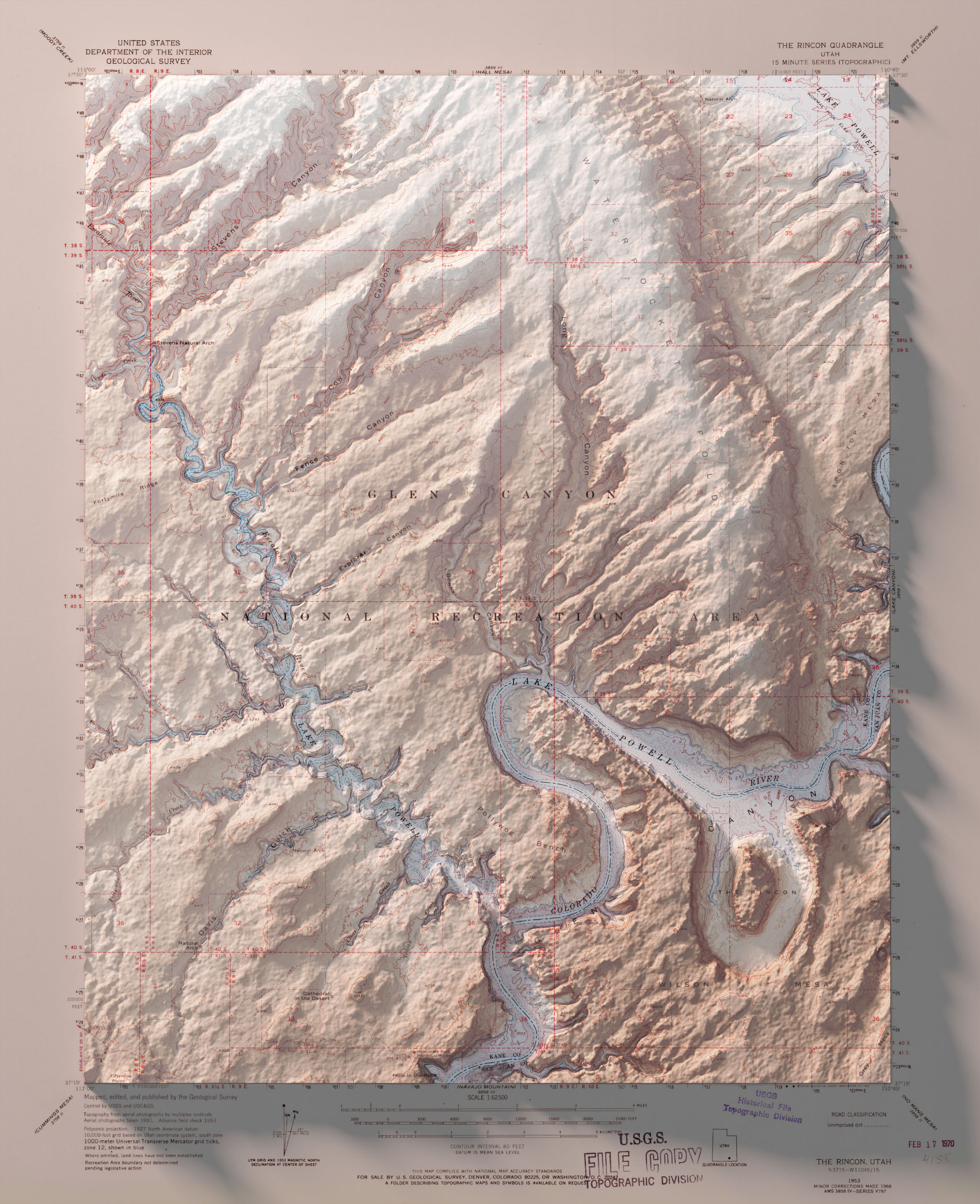
One of my favorite places to see in imagery and maps is Glen Canyon National Recreation Area and The Rincon. Here, water meets stone as myriad canyons reach out from the serpentine courses of the Colorado and Escalante Rivers.
Topographic maps of areas like this are remarkable contradictions. Rugged and irregular landscapes perfectly conveyed by smooth lines, flowing typography, and a precision that is more architectural than anything that truly exists within the neatline of the map.
I’ve been exploring psuedo raised-relief maps, so naturally I had to make one of Glen Canyon. I combined a 1970 release of a USGS topographic map with Space Shuttle Radar Topography Mission (SRTM) data from 2000 in Blender, a free and open source 3D rendering software.
Using the SRTM data to ‘raise’ the topography off the map, and an atmospheric lighting to compliment the red, rocky tones of the landscape, I produced the map below.

Glen Canyon National Recreation Area is a geologic panorama of meanders past and present. View larger.
Warm vistas cast long shadows over the pale, cool waters of Lake Powell. The Rincon, a feature formed by an abandoned meander thousands of years ago, calls from the viewer an attention no longer given to it by the Colorado River.
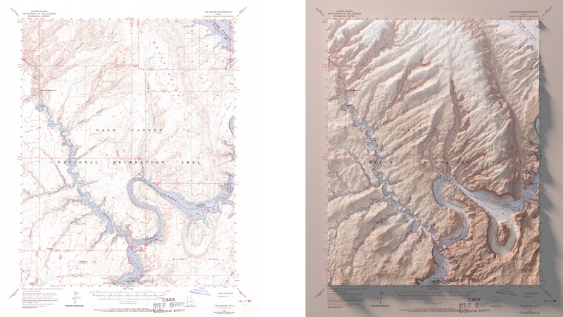
The original USGS map before (left) and after being revitalized with raytraced shadows (right).
Bonus: Rincon Wallpaper
I liked the way this render came out, so I turned it into a desktop background. Click the image below to download a 1920 x 1080 version for yourself.
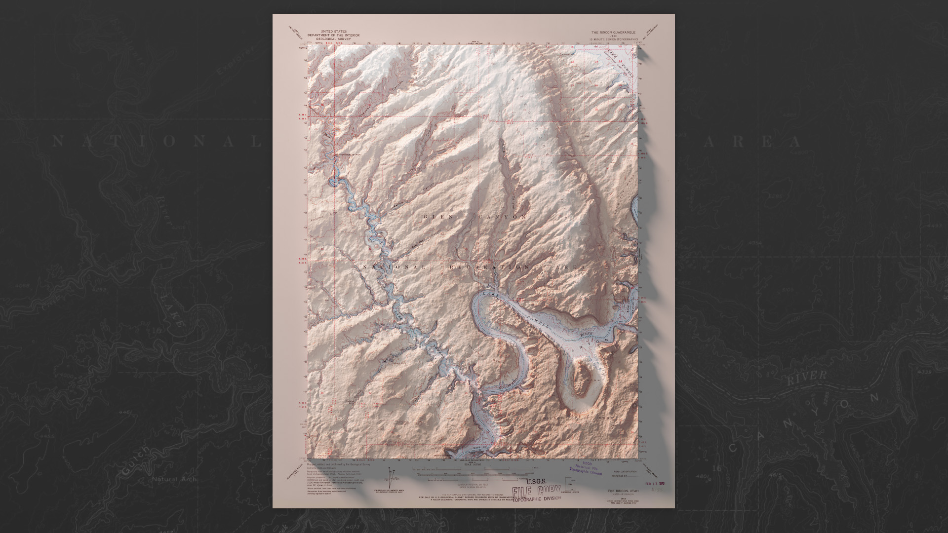
The Glen Canyon/Rincon render makes a perfect desktop background. Download the 1920 x 1080 version.
If you’re interested in making these kinds of topographic mashups, I’ve written a brief overview of the process in my previous post.