Topographic Diversity of the Contiguous USA
March 21, 2019
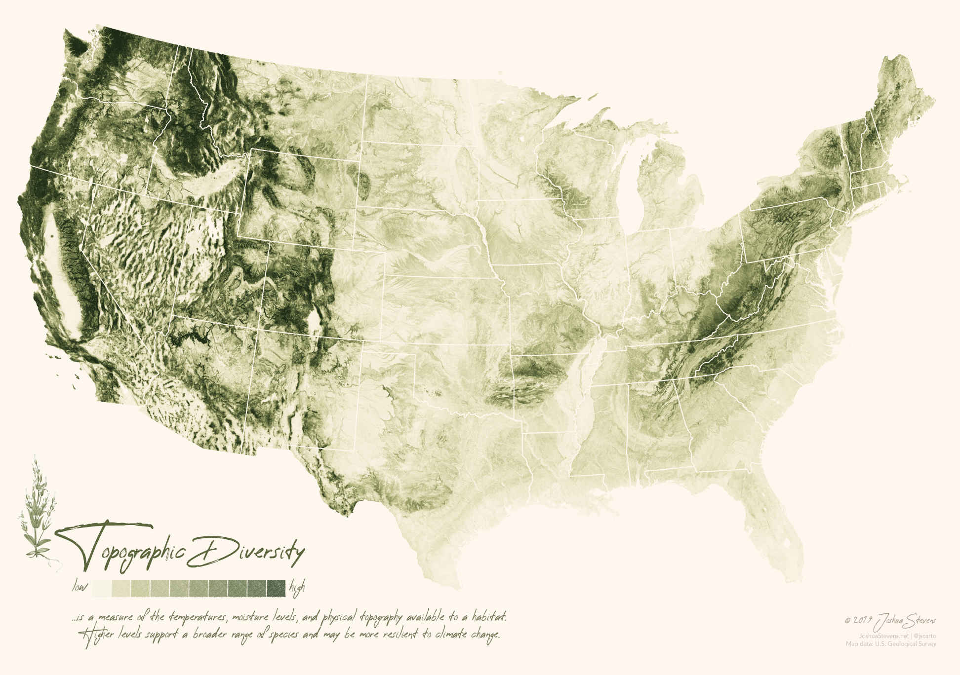
While exploring data offered within Google Earth Engine (as I am wont to do), I came across a gorgeous and elegant layer from the U.S. Geological Survey.
This data, which represents “topographic diversity,” immediately conveys exactly what it aims to: topography. But the ridges and valleys are not representative of Earth’s bumpy surface alone.
These valleys and ridges are composed from proxy data that captures temperature ranges and moisture levels in addition to the terrain. In other words, diverse habitats drive the topography as much as the hills do. What’s more, these values reflect areas that may be the most resilient in the face of our ever-changing climate.

If you like this map, consider buying a poster of it!